Don’t have the app? Download it now!

360 GeoDynamics Ltd.
About
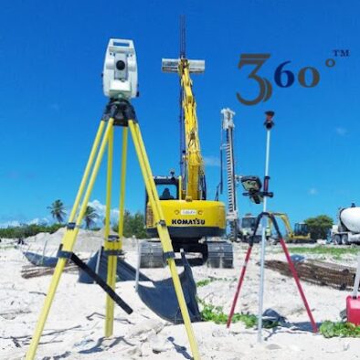
360 GeoDynamics Ltd. is a specialized geospatial and surveying services company operating in Antigua and Barbuda, providing advanced land measurement, mapping and data solutions for both public and private sector projects. The company offers professional services such as land surveying, GPS and GNSS data collection, drone based aerial mapping, topographic surveys and geospatial analysis to support construction, infrastructure development, land management and planning. 360 GeoDynamics Ltd. emphasizes accuracy, modern technology and data driven results, using innovative tools to deliver reliable spatial information that helps clients make informed decisions. The company serves developers, engineers, architects and government agencies, positioning itself as a key technical partner in Antigua and Barbuda’s development landscape. With a strong online presence highlighting field operations and completed projects, 360 GeoDynamics Ltd. is recognized for its technical expertise, precision and commitment to high professional standards within the geospatial services sector.